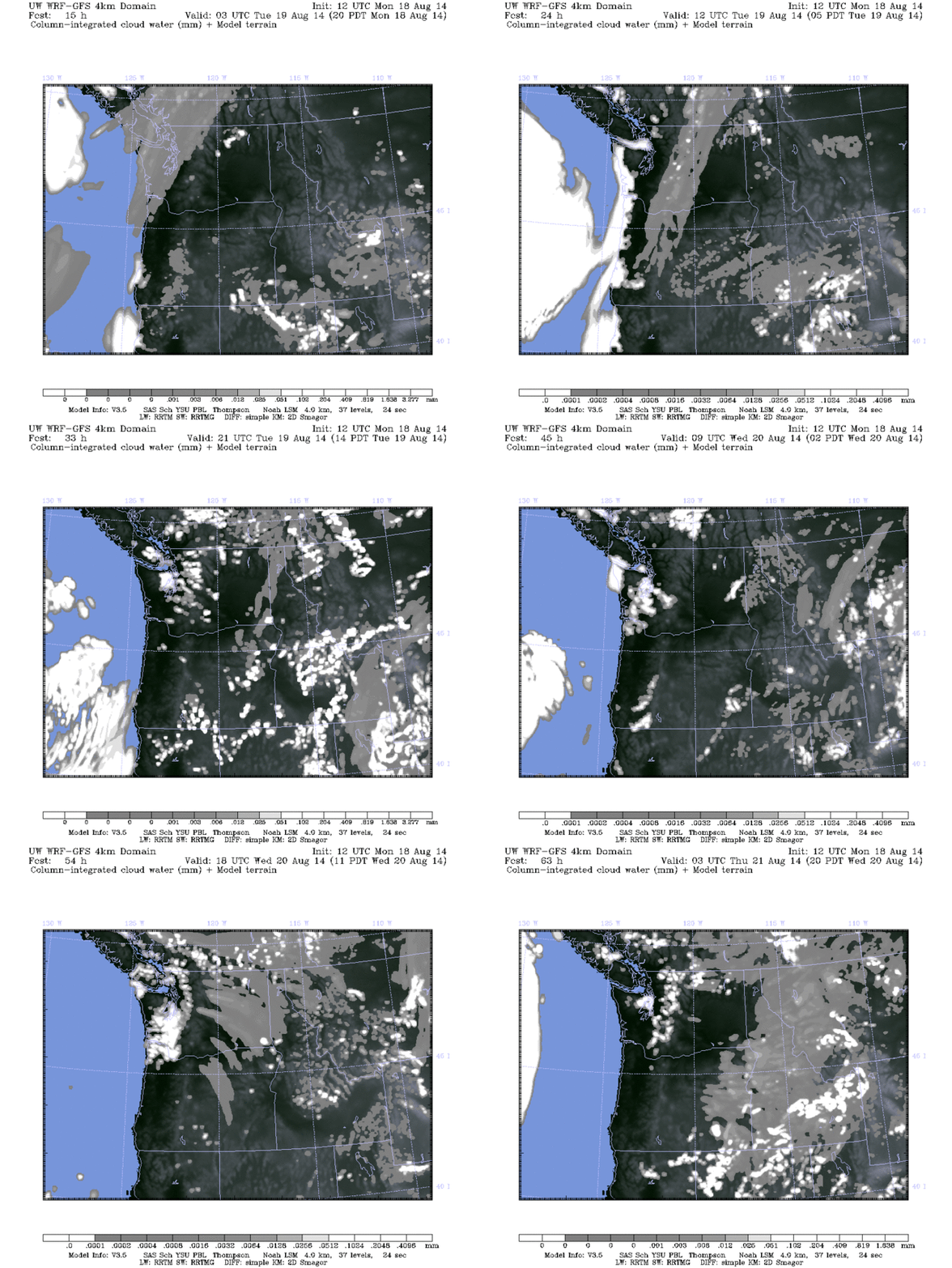
Pretty good weekend in my eyes. It was warm enough to enjoy some time outside, but not as hot as it has been so it was a little bit more bearable. Sunday did see a little bit of a warm up, but other than that, it was pretty good.
Recap
Saturday – High 78°F, Low 60°F; Scattered clouds throughout the day, thicker in the morning. Winds picked up a little bit in the afternoon as well, but it was a little breezy for a good portion of the day.
Sunday – High 82°F, Low 63°F; Scattered clouds in the morning, clearing up to clear skies in the evening. There was still quite a bit less cloud cover compared to Saturday so the temperatures jumped a little bit. Winds were breezy for most of the day as well.
Monday – High 85°F; Clear skies for most of the day with increasing clouds towards the evening, with some breezy conditions later in the day.
WARNINGS – It looks like the only warning out right now is a Small Craft Advisory for the northern waterways. For more info about watches and warnings, please see here.
FIRES – Fire report was filed as of 9:25am 8/18. At this point we have 10 large fires in Washington; 2 have a Type 2 Incident Management Team (not as bad, but still bad), and the rest have a Type 1 Team (pretty bad). The 2 Type 2 fires are Haven Lake near Olympia (91% contained), and Devils Elbow Complex near the Colville Indian Reservation (60%). For the 8 larger Type 1 fires, we have the Chiwaukum Complex near Leavenworth and Entiat (70%), South Cle Elum Ridge near near Cle Elum (77%), Duncan near Entiat (0%),
Little Bridge Creek near Winthrop (37%), Snag Canyon near Ellensburg (76%), Hansel Creek near Leavenworth (0%), Carlton Complex near Okanogan, Twisp, and Omak (95%), and Upper Falls near Winthrop and Omak (35%). For a map of the fire locations click here, and for details on the fires themselves click here.
A small ridge was trying to build on Monday, but the jet stream isn’t having any of that. Overnight it will dip to the south, which will work on cooling things down again. By Wednesday morning it looks to dip a little bit more, so this thing looks to stay for at least a little bit. It may bring in some more clouds, and possibly some rain, but we’ll see how that goes.
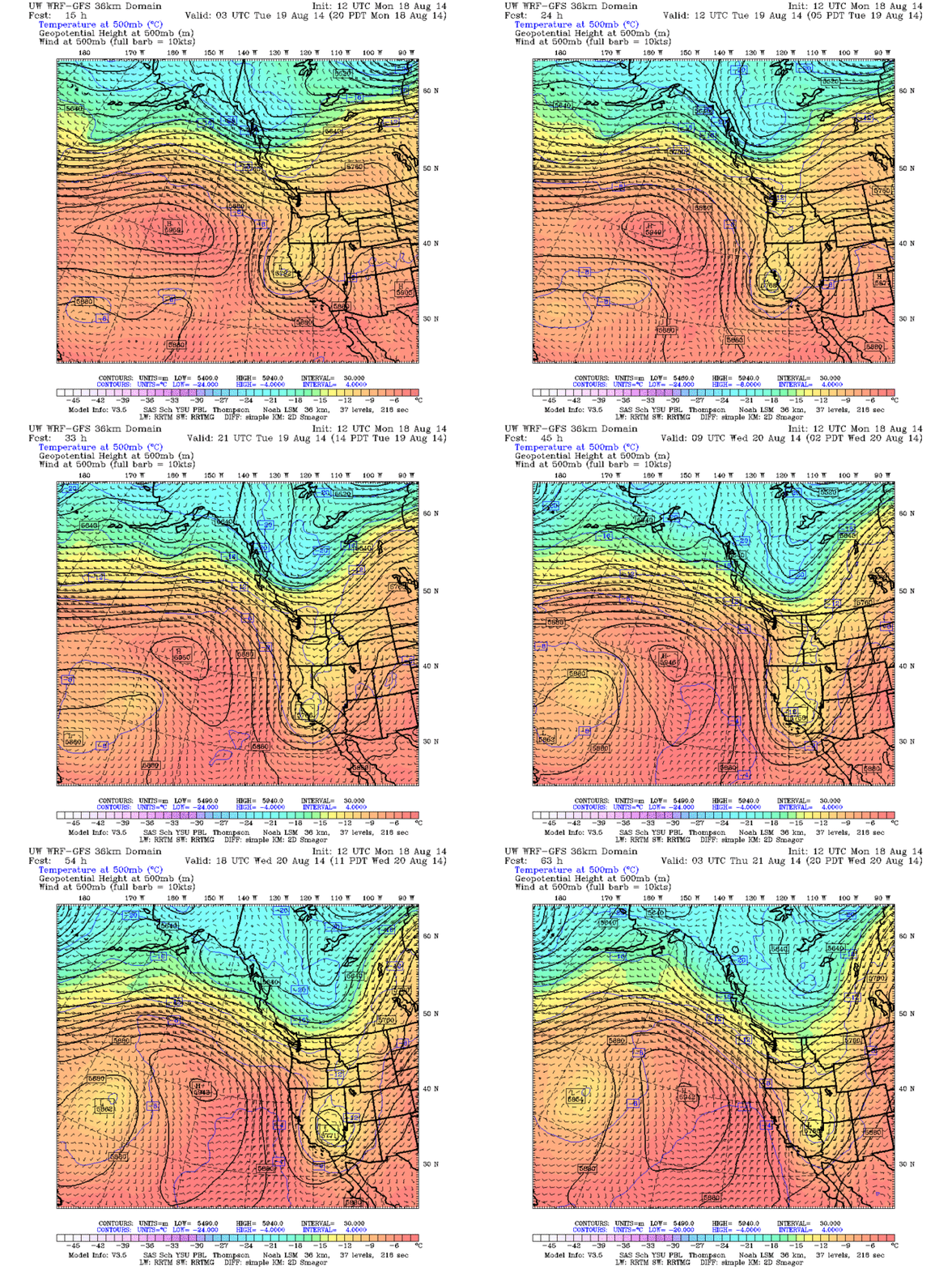
Looks like a trough will start to build in the area over the next few days, cooling things off again. SOURCE: UW Models; 36km 500mb; Temps, winds, heights
I’m not really seeing anything on the sea level pressure map. We still have the high pressure way off over the Pacific, and it looks like the Olympics are creating a small low in the area. Now this isn’t going to be creating any fronts at all, but it may develop a little bit of rotation, like we saw a while ago when we had all of that rain. I won’t be posting this model today.
It looks like there will be some scattered showers overnight, mainly for north Sound and the Olympics. By late afternoon/early evening Tuesday it looks like some more showers will develop, this time in both mountain ranges. The models are also saying some of these showers will move down over Kitsap, south and central Sound, but they will mainly stick to the mountains. Wednesday will be mostly dry with the exception of a couple showers in Olympics and possibly south Sound. There is a little bit of color on the CAPE model for Tuesday, around the time the showers pop up. It looks like there’s a chance, but the CAPE is looking pretty weak so I’m not holding out much hope for thunderstorms.
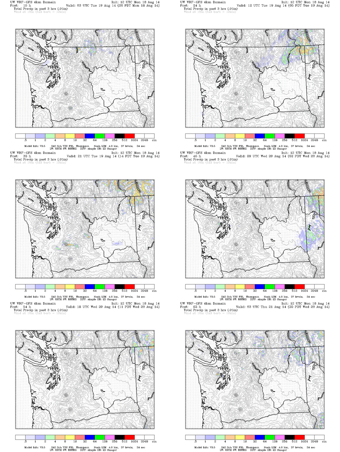
A few showers will move into the area, but they will mainly stick to the mountains with the exception of Tuesday evening. SOURCE: UW Models; 4km Precip; 3-hour precipitation; WA 3-hour precipitation
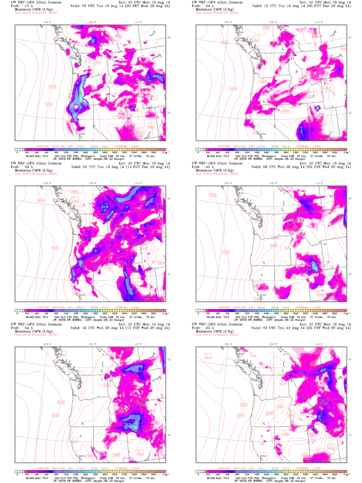
Only reason I’m posting this is the small bloom in the Olympics/Kitsap on Tuesday. I don’t hold out much hope for thunderstorms though. SOURCE: UW Models; 12km Surface; CAPE (Convective available potential energy)
Tuesday will start out with morning clouds, mainly for north Sound, but there could be patches of fog here and there as well. This should burn off relatively quickly in some areas, but by afternoon clouds will start to build up again, mainly over Kitsap and the Cascades, and by late evening it will encompass the majority of the Sound. Wednesday morning will start off cloudy with a chance for patches of fog. Most of this should clear by the afternoon, but some of it will still stick around.
Here are the 24hr precipitation totals.
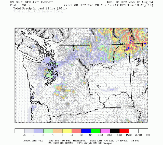
24hr precipitation totals as of Tuesday evening. SOURCE: UW Models; 4km Precip; 24-hour precipitation; WA 24-hour precipitation
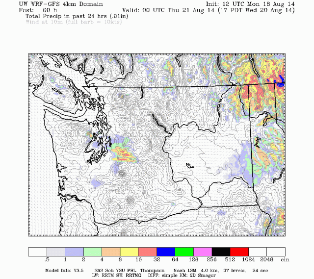
24hr precipitation totals as of Wednesday evening. SOURCE: UW Models; 4km Precip; 24-hour precipitation; WA 24-hour precipitation
The winds look to follow the same general trend as we’ve been seeing, but a little stronger. Tuesday will start out relatively calm with the exception of the Strait, and will slowly start to pick up as the day progresses for the entire area (including the Strait). By late afternoon/early evening, winds will be at their strongest. Areas to note for stronger winds will be southern Kitsap Peninsula/Mason County area, the Strait, and northern/southern Puget Sound. These will start to calm again overnight, and from there things look to stay relatively clam. The areas mentioned previously will see stronger winds compared to other places, but a bit weaker than on Tuesday.
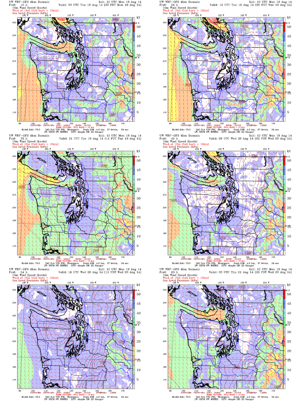
Winds will be a little stronger than we usually see Tuesday, but all in all we’ll still follow the same trend we’ve been seeing. SOURCE: UW Models; 4km Surface; 10m Wind Speed; Western WA 10m Wind Speed
As hinted at above, we’ll see another little cool down starting tomorrow, and preliminary readings look like it will stay that way for at least a little bit. We’re still in the (average) hottest month of the year, but we’re also getting towards the end of that month. Tuesday will see highs in the mid 70s for south Sound and larger metro areas, with temperatures cooling (but not by much) in central and north Sound, and over Kitsap. Lows will be in the high 50s to low 60s. Due to the increase in cloud cover, Wednesday will see slightly cooler temperatures, with highs in the low 70s for the entire Sound, cooling as you move closer to the larger bodies of water. Lows will be in the high 50s.
TL;DR: Increasing clouds, cooler temperatures, it’s like we’re getting closer to fall or something…

