That reference song calls for rain, but unfortunately that isn’t the case for us. Hopefully you didn’t put your fans and AC units away!
Recap
Monday – High 77°F, Low 61°F; Scattered cloud cover in the morning, clearing up for the most part by the afternoon. Winds were actually breezy in the morning and calmed down by late afternoon, which is a little different than I had put in the previous forecast.
Tuesday – 83°F; Mostly clear all day, with the winds picking up by late morning.
WARNINGS – We only have 2 warnings to be aware of for this forecast. The first is the usual Small Craft Advisory for the Strait. The other one is a Special Weather Statement (vague, I know) for the entire Puget Sound area, warning about the extended heat wave coming up. For more info, please see here.
FIRES – Fire report current as of 10:53am. Only 2 fires for this batch. First up is the Blue Creek fire near Walla Walla. Fire fighters have made some improvement, with 6,004 acres consumed at currently at 73% contained. And the last one is the North Boulder 2 fire near Orient. It is at 22% containment, and has consumed 175 acres. For a map of the fire locations see here, and for details on the fires themselves see here.
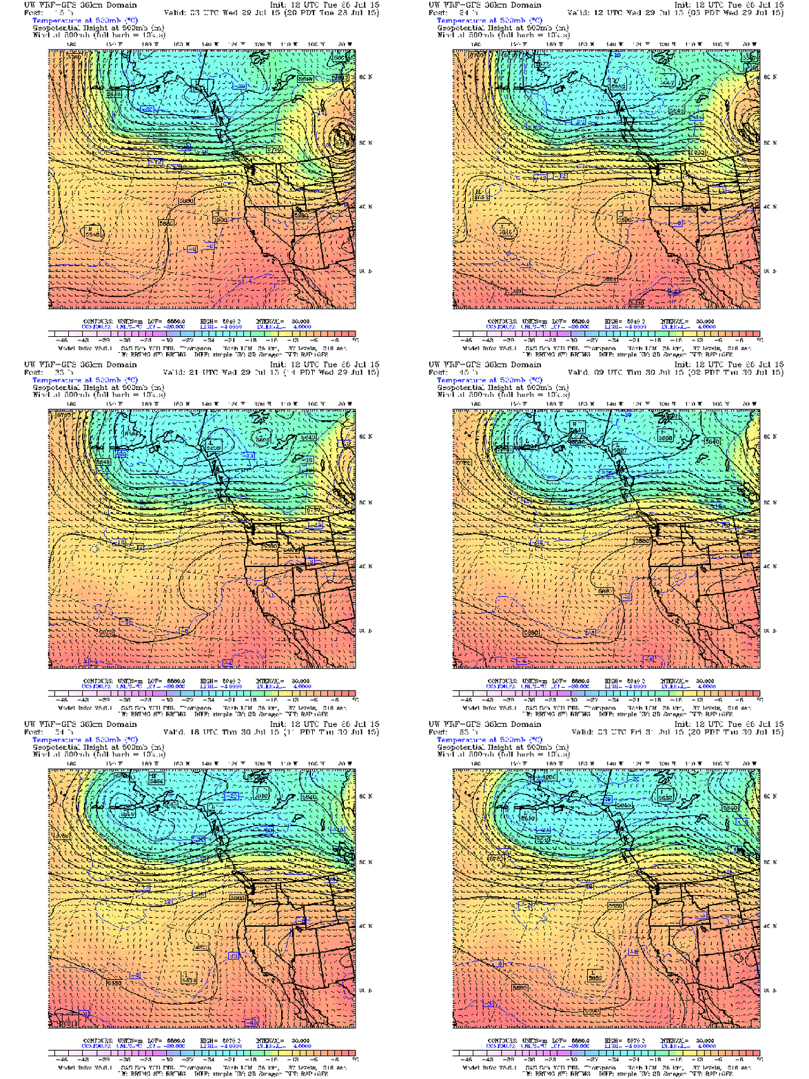
The jet stream will start to shift north Wednesday morning, so we can expect the warm up to start tomorrow. It will stall for the most part by Thursday morning, which will keep that warm air mass parked right over us for a while.

The jet stream will start moving north, bringing in the hot air from the south. SOURCE: UW Models; 36km 500mb; Temps, winds, heights
High pressure will stick around, with a large high center out over the Pacific. No fronts or isolated lows in the area, so I will be skipping this model.
As I hinted at last forecast, and as I’m sure you can figure out from the given info already, we can expect a dry midweek. No rain or showers moving in, and the CAPE is pretty blank as well. Since both models are empty I will not be posting them either.
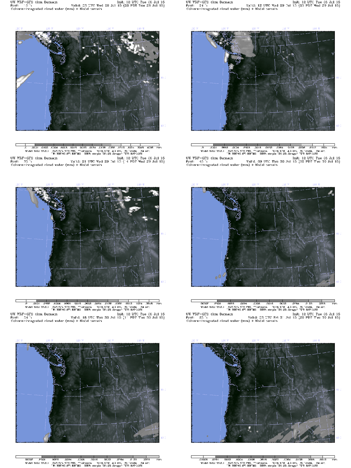
With high pressure sticking around, skies will be clear all day for the next couple of days. Humidity is looking to stay on the dry side and there isn’t a whole lot of onshore flow (winds coming from the Pacific), so I’m not expecting too much in the way of morning clouds/fog. With that said, some may pop up but I doubt it.

Clear skies for the next couple of days, with a few clouds up in the mountain. SOURCE: UW Models; 4km Cloud; Column-integrated cloud water
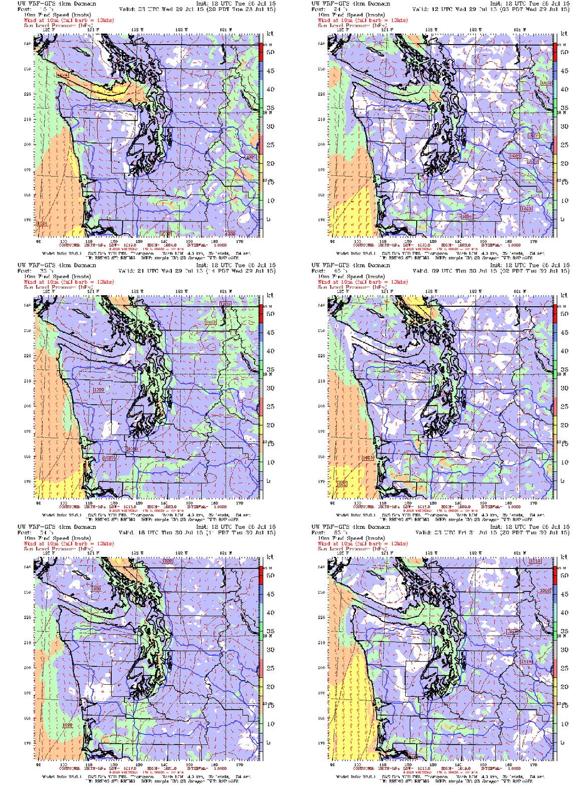
Winds will be following the same general trend for the summer. Calm in the morning, picking up in the afternoon. The slight exception is overnight Wednesday and into Thursday. While the winds will follow the general trend, areas in central Sound (mainly over Kitsap, the entrance to Hood Canal, and over the water) will see windy conditions overnight and into Thursday morning. After that the winds will pick up and be fairly windy for the entire Sound.

Winds will be overall calm in the morning and breezy in the afternoon, but Thursday morning is looking to be blustery in places. SOURCE: UW Models; 4km Surface; 10m Wind Speed; Western WA 10m Wind Speed
Now for the temperatures. And as I’ve been saying, it’s going to be hot. Wednesday will see highs in the mid to high 80s for most of us, warming a bit to the south. Lows will be in the low 60s, with some areas cooling a little bit more with the clear skies. Thursday will (for now) reach the peak temperatures for the week, with highs reaching into the high 80s, with a few places likely to at least hit 90 (and possibly higher). Lows will be about the same.
TL;DR: Keep the water handy. You’re going to need it.
