
We got a little bit of thunder action yesterday, although I only heard about up north and near Seattle. There wasn’t a whole lot, but there were definitely some strong cells that moved through.
Recap
Tuesday – High 62°F, Low 48°F; Scattered showers throughout the day, with a thunderstorm or two popping up in the afternoon. Boeing Field registered around a quarter of an inch in rain, with the heaviest in the morning and evening. Winds were on the gusty side, with gusts up to 24mph. Skies were mostly cloudy as well.
Wednesday – High 64°F; Scattered clouds throughout the day, with the winds picking up during the afternoon.
WARNINGS – Same as the past week or so, all we have is a Small Craft Advisory for the northern waterways. for more info, please see here.
As we saw towards the end of the last forecast, the low that brought in the rain and thunder will weaken and continue moving away from us. By Thursday morning we will be transitioning into a ridge, which will help clear things out and warm us up a little. The ridge will continue to build through Thursday, and by Friday the jet stream will start to ship it over us.

A ridge will build on Thursday and start moving in on Friday. SOURCE: UW Models; 36km 500mb; Temps, winds, heights
With the ridge building off the coast, the surface pressure will start to build as well, but won’t really make a move until Friday. Regardless the pressure will build over us as well, which should help clear things up. We’ll see that for sure below, but since there isn’t too much on this model I will be skipping it.
Showers in the mountains will dry out overnight, then we’ll stay that way for the rest of the work week! With no precipitation, there’s no snow, and the CAPE model is bare so no surprise thunderstorms or dry lightning either. Since there is nothing on these models, I won’t be posting them.
As I mentioned, the high pressure will start to help clear things out, but we’ll still have some moist air in the area. This means we will have some low clouds and fog in the mornings, clearing up by noon. I’d say rinse and repeat for Friday, but since there isn’t any rain, we’ll just repeat for Friday with less fog.

Morning fog mainly on Thursday, but after that clear skies for days (at least until Friday). SOURCE: UW Models; 4km Cloud; Column-integrated cloud water
Winds will be following the same trend that we’ve been seeing for the past few days. We’ll start out fairly calm on Thursday, with winds picking up by the early afternoon. Strongest winds will be over the water. Winds will calm again overnight, except for some areas over the Sound waterways, and all areas will see an increase by early afternoon once again. They should calm again by the end of the forecast.
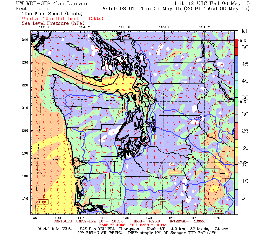
Winds will be on the calm side during the morning/afternoon, and pick up a little bit by the evening. SOURCE: UW Models; 4km Surface; 10m Wind Speed; Western WA 10m Wind Speed
As I hinted at above, we can expect the temperatures to climb once again. Highs on Thursday will reach into the high 60s for the entire Sound, cooling a little as you move closer to the larger bodies of water. Lows will dip down to the high 40s due to the lack of cloud cover. Expect warmer temperatures on Friday as the ridge moves in, with highs in the low 70s, once again cooling closer to water, and with a warm spot over Kitsap and parts of south Sound. Lows will be in the high 40s to low 50s.
TL;DR: It’s going to be nice!
